https://creativecommons.org/publicdomain/zero/1.0/https://www.rawpixel.com/image/2041320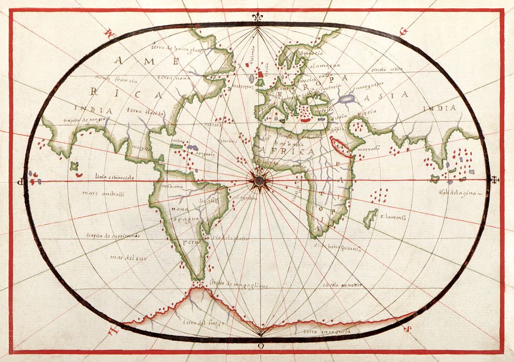
Portolan atlas of the Mediterranean Sea, western Europe, and the northwest coast of Africa: World map drawn on an oval projection (ca. 1590) by Joan Oliva. Original from Library of Congress. Digitally enhanced by rawpixel.
Portolan atlas of the Mediterranean Sea, western Europe, and the northwest coast of Africa: World map drawn on an oval projection (ca. 1590) by Joan Oliva. Original from Library of Congress. Digitally enhanced by rawpixel.
Public DomainFree CC0 image for Personal and Business use